
This is the 3rd in a four-part blog. You may want to skim through "Part 1: What's so important about an address?" and Part 2: Addressing the hard way (manually) in Epworth, Zimbabwe" before continuing ...
Fast
forward to 2017, to a pilot water improvement component under the World
Bank-supported Kiribati Adaptation Program Phase III (KAP III). Kiribati comprises 32 low atolls and a raised
coral island scattered over 3.5m km2 in the center of the Pacific
Ocean. This nano-country’s 110,110
people live on 21 of the atolls, most of which are less than 2 km wide and are no
more than 6 m above sea level at their highest points. About half of Kiribati's population lives in the main town of South Tarawa, in largely
unplanned and critically under-serviced urban ‘villages’. Living conditions in many of these urban
villages are as challenging as can be found in the slums of much larger,
rapidly growing cities in the global South, and for the same underlying reasons. After years of unmanaged and unattended
urban growth, policy neglect and lack of investment in new serviced lands, South
Tarawa’s residents, and especially the middle- and low-income groups, face an
across the board lack of even basic lifeline services and have limited housing
options other than to crowd into the existing housing stock or self-build on
marginal lands. The result has been a huge
public health load of preventable diseases such as infant diarrhea, worm
infestations in children, adult pneumonia, and other infectious diseases (“Health
and the City: Consequences of the ‘King Tides’ of Urbanization in Kiribati”).
Payments for any urban services are tied to effective demand of the customers. In the case of the pilot zones, this was determined as the residents’ ability to pay the new tariffs (based on the water utility’s experience of what would be affordable to residents as there was no recent household income information) and their willingness to pay for the service. It also became apparent during construction that willingness to pay is tied to not only an improved, engineered water service (reliable, 24/7, pressurized, clean supply) but to the ease with which one can receive bills, make payments and report faults that need fixing. Asking someone where they live in Tarawa elicits a response such as "Nanikai airiki " (oceanside) or "Tebikenikora tanrion" (lagoon side) – not particularly useful for delivering a household water bill or for following up on overdue payments or reporting a faulty meter for quick attention. In December 2017, we met with around 30 local experts – from the Public Utilities Board, Ministry of Lands, National Statistics Office, Kiribati Postal Services and project staff to find an answer to how to provide addresses to nearly 500 houses before the new water supply was turned on.
Kiribati has various existing land/building registers – the formal Ministry of Lands’ cadaster, the Kiribati Housing Corporation’s list of public housing, and the Public Utility Board’s list of customers and existing water meters. There is also a somewhat opaque “Me + brothers + sisters” vernacular system in use and the churches keep a list of members and church-owned houses and buildings. However, none of the systems is up to date or has full coverage, there is no common ‘key’ to easily link and combine or overlay the different systems, and several errors were found when trying to map the underlying data including that several houses appeared as located in the ocean! (See figure below).
Kiribati has various existing land/building registers – the formal Ministry of Lands’ cadaster, the Kiribati Housing Corporation’s list of public housing, and the Public Utility Board’s list of customers and existing water meters. There is also a somewhat opaque “Me + brothers + sisters” vernacular system in use and the churches keep a list of members and church-owned houses and buildings. However, none of the systems is up to date or has full coverage, there is no common ‘key’ to easily link and combine or overlay the different systems, and several errors were found when trying to map the underlying data including that several houses appeared as located in the ocean! (See figure below).
 |
| Nanikaai, South Tarawa - mismatch between building footprints as digitized in Ministry of Lands’ cadaster, engineering drawings and actual location of existing water customers prior to KAP III investments. (Generated by Gollach using ArcGIS, June 2018)
At
first, there was unanimous agreement to a suggestion to use street names and
numbers as found in planned cities around the world. However, as we had found in Epworth all those
years ago, it was recognized that it would take months of politically charged
discussions to agree on names for existing streets and anyway, in most
villages, access ways were footpaths rather than any well-defined hierarchy of
roadways. Our Expert Group recalled
that in the 1980s, all houses on South Tarawa had been physically numbered by
the authorities. As with Epworth, it had
taken many person-months of time and effort to do this valuable exercise. Unlike in Epworth, the Tarawa numbering
system had not been disaggregated by areas and it did not allow for future
infill or new development; the numbers ran from 1 to n in increments of 1 and
the system had not been maintained and had not kept up with urban expansion or infill since then.
Might it be possible to send out teams with GPS handhelds and once again number all the houses in the pilot zones using geographic coordinates? The net of latitude and longitude has stood
up well everywhere across the globe since John Harrison, a self-educated
carpenter from humble beginnings, turned his hand to clockmaking and, after
many years of effort “wrested the
world’s whereabouts from the stars, and locked the secret [of longitude] in a
pocket watch”. There are countless
examples internationally of successful community mapping initiatives and the
empowerment that self-profiling produces.
Perhaps the communities themselves could be meaningfully engaged in
identifying the coordinates for their houses?
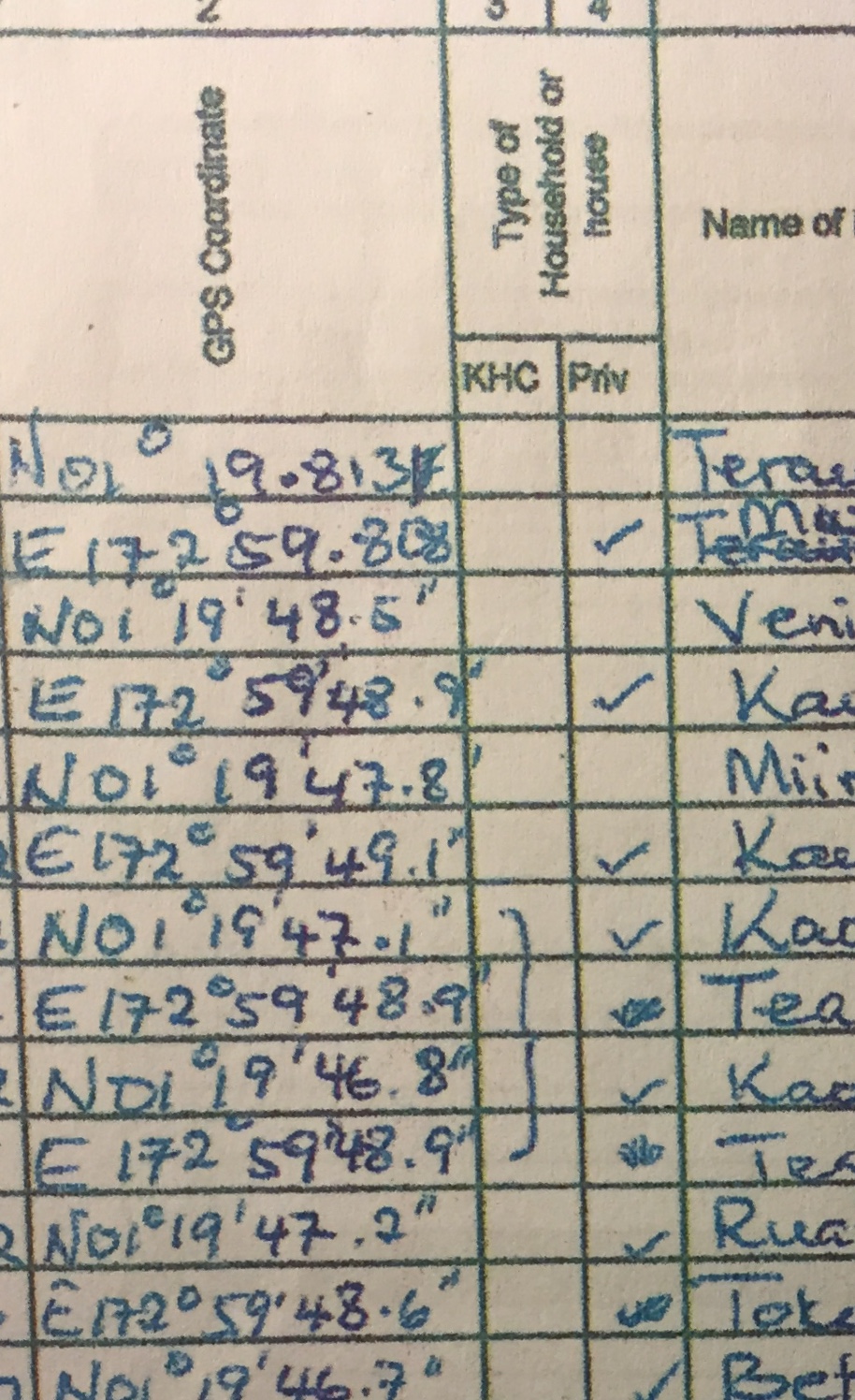
However, some worried about the availability and costs of handhelds on
the small remote island; others were concerned about the potential for human
error and the difficulty for households to accurately remember their address in
a GPS format (see example to left). Nonetheless, an addressing system based on
point-based geographic coordinates and using technologies for fast and accurate
inputs held promise.
Several coordinate-based, free or open-source addressing systems have emerged recently. One of the first, GOCode which was born out of community mapping, converts coordinates into easy to remember 7- to 9-character alphanumeric codes, such as “L6G 56LP”. However, GOCode had limited coverage (India, Ireland, Kenya, Ghana and Ecuador but not Kiribati). A similar coordinate-based system has recently been developed by Google Plus Codes. The plus code – available once a point is tagged in Google Maps, consists of 6 or 7 letters and numbers and the town or locality name, for example “VXX5+J2 Washington, District of Columbia, USA”. Places that are close to each other have similar plus codes which the company states should make it easier to identify addresses that are near each other but might compound human errors when recording the addresses. At that time, the Plus Codes system wasn’t yet available but does seem worth piloting in unplanned settlements in the future.

We finally settled on a system that the Kiribati Postal Service had signed up to but hadn’t yet been able to put in place, namely “What3Words”. What3Words runs on a commercial app that can be downloaded and used freely on smartphones which are now ubiquitous even in small and remote countries. The system divides the world into a 3m X 3m grid. Every cell (square) across the globe - on land or sea, is given a unique 3-word address. The company is quick to point out that a similar 3m accuracy using GPS coordinates would require 16 digits per address – both difficult to remember and easily corrupted. The system can be used both offline (Open Street Maps base) or online (satellite image base). Counter-intuitively, in a country where English is a second language, we found that the water utility field staff and households easily recorded and remembered addresses such as “unspeakably.dread.gymnasium” rather than the coordinates “1.32995484, 172.9954361”. After brief training, the What3Words addressing system was accurately and rapidly rolled out at very low cost in the three pilot villages by field staff and a local youth group, providing addresses to 440 houses. Each handwritten address was proudly taped onto the house by the hitherto unidentifiable household. The 3m grid meant that different, unique addresses could be provided to separate water meters in multiple occupancy houses. The words are deliberately random. This has the disadvantage that unlike a conventional street numbering system, there is no discernible pattern to the addresses and so no resultant ‘sense of place’. But equally, it ensures that misspellings can be easily identified and corrected in the type-ahead or speak-in functions of the easy-to-use app.
There were a number of useful lessons we learnt in the field in applying a disruptive technology in the small developing country Kiribati. Different quality smart phones have different levels of accuracy although most are typically to within a 5m radius under conditions of clear skies. Accuracy was affected by large trees and weather conditions such as approaching thunderstorms. This, coupled with the small 3m grid meant that even a mid-sized house might have two or more W3W addresses. We offered the household the choice over which they preferred (and blamed ‘the satellite’ when none of the words was to their liking!) In the pilot zones, we addressed the household’s water meter whereas the Postal Services prefers to address the main external door. Either way, the correct house is usually easy to find based on the selected address, even in dense settlements.
There is a healthy and ongoing debate around whether to use proprietary vs. open source software. For now, What3Words and Google Plus Codes are free to use and the companies sitting behind the software offer updates and technical support to their users. What3Words offers plug-ins for interoperability/working in QGIS and ArcGIS and the UN has recently integrated W3W as a geo-referencing system into its disaster reporting app UN-ASIGN to tag photos and damage reports. When we requested mass use/ batch conversion for more than 25 addresses from geographic coordinates (or vice versa), the company always responded within 12 hours and helpfully allowed us to do so. As a back up measure to ensure the integrity, independence and permanence of the addressing system, the W3W addresses were entered into the water utility’s records alongside the meter serial number and other customer details together with the underlying geographic coordinates and accompanying maps. Overall, the addresses in the pilot zones were assigned easily and at very low cost. We continue to use the system elsewhere in the Pacific Islands and South Asia, for example to assist survey enumerators locate randomly selected households for planning purposes, identify households falling behind on water payments for personalized visits, and for government officers on remote outer islands to create inventories of rainwater tanks and other physical assets.
 This is the end of the 3rd part of this four-part
blog. “Part 4: The choice is ours - disruptive or disrupting?" continues below. |
No comments:
Post a Comment